13 colonies map: the original 13 states
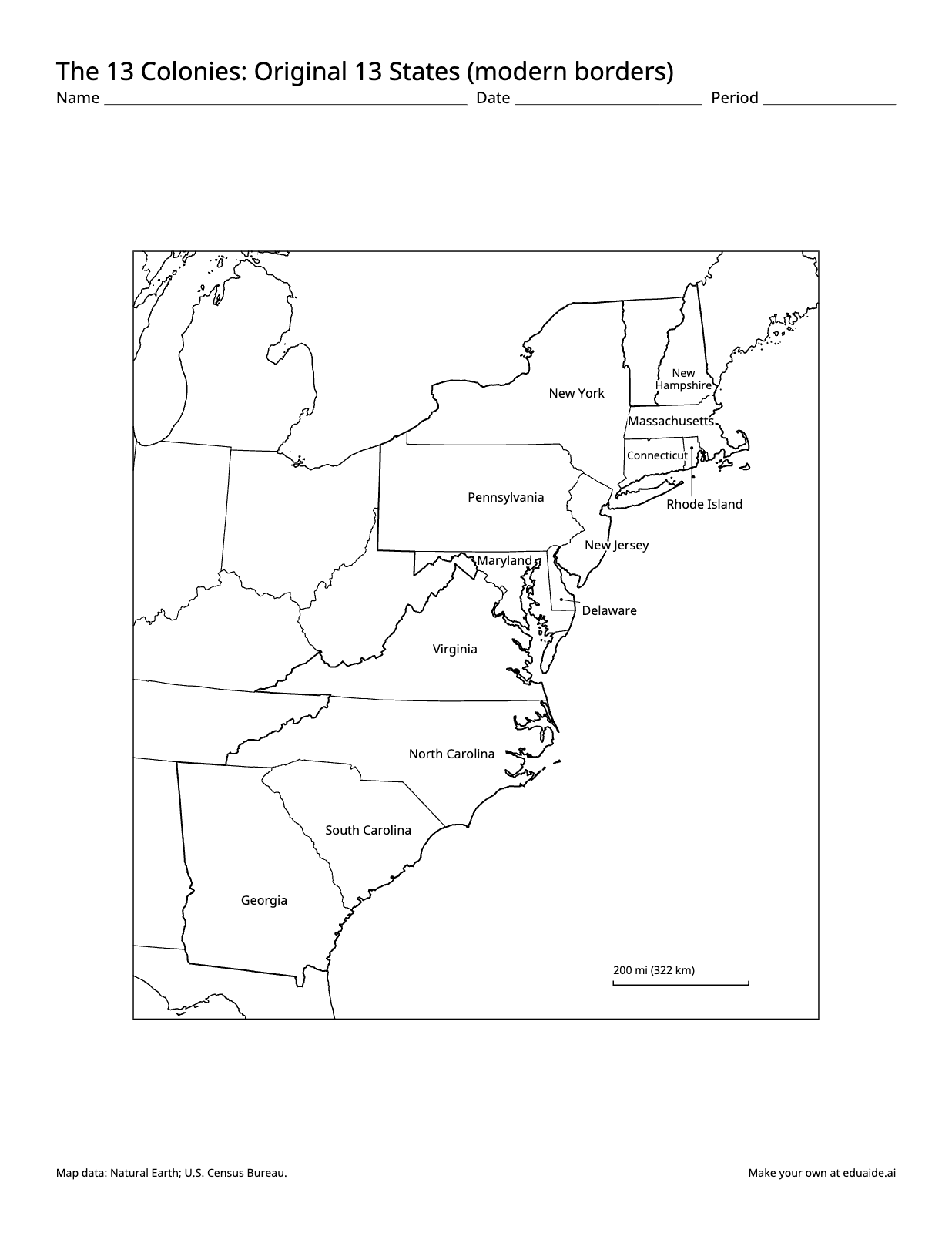
Map worksheet: The 13 Colonies: Original 13 States (modern borders). Labeled on the map: New York, north; New Hampshire, northeast; Massachusetts, northeast; Connecticut, northeast; Rhode Island, northeast; Pennsylvania, north; New Jersey, center; Maryland, center; Delaware, center; Virginia, center; North Carolina, center; South Carolina, south; Georgia, southwest.
No account needed for the maps. The 13 colonies quiz is free with an Eduaide account. Numbered quiz of the 13 states with answer lines and a word bank, Version B, and an answer key for each version.
How teachers use it
Know what this map shows
This map draws the original 13 states with today's state borders. It is the map most US history classes use to locate the colonies, but the borders are not the ones of 1775. Maine was part of Massachusetts until 1820, Vermont was land disputed between New York and New Hampshire, West Virginia was part of Virginia until 1863, and several colonies claimed land far to the west of the borders shown here. Tell students this before they label it, and the map becomes a lesson in how borders change.
Use the blank map to start the unit
Give students the blank map on the first day and ask them to shade the 13 colonies they can name. Then group the colonies by region: New England (New Hampshire, Massachusetts, Rhode Island, Connecticut), the Middle Colonies (New York, New Jersey, Pennsylvania, Delaware) and the Southern Colonies (Maryland, Virginia, North Carolina, South Carolina, Georgia). Students can color each region and add a legend of their own.
Keep the labeled map in notebooks
The labeled map names all 13 states. Rhode Island, Connecticut and Delaware are small at this scale, so their names sit beside them on short lines. Students can use the labeled map as a reference while they add the Atlantic Ocean, the Appalachian Mountains or the major colonial towns of their reading.
Quiz with a key
With a free account you can download a numbered quiz of the 13 states with answer lines and a word bank, a Version B with the numbers shuffled, and an answer key for each. There is also a 13 colonies map quiz page that shows the quiz itself.
Standards it supports
- C3 Framework, Geography: D2.Geo.1.3-5, constructing maps of places, and D2.Geo.2.6-8, using maps to explain relationships between the locations of places and regions and changes in their environmental characteristics.
- C3 Framework, History: D2.His.1.6-8, analyzing connections among events and developments in broader historical contexts, for a unit on colonial America.
- State standards for colonial America, often in grade 5 and middle school US history, where students locate the 13 colonies and compare the New England, Middle and Southern colonies.
Printing tips
Print at 100% scale on US letter paper. The lines are heavy enough to photocopy, and each page keeps a small credit line for the map data.
What teachers ask about these maps
Is it free?
Yes. The blank and labeled maps download free, with no account. A free Eduaide account also unlocks the 13 colonies quiz, and no credit card is needed.
Do I need an account?
Not for the blank and labeled maps: download them straight from this page. The numbered quiz, Version B and answer keys need a free account, made with Google, Microsoft or your email.
Can I copy these maps for my class?
Yes. You may print, copy and share them with the students you teach and their families, in a school, a homeschool or a co-op. Please keep the map data credit at the bottom of each page, and don't sell the maps.
Are these the borders of the colonies in 1775?
No. The map uses today's state borders. In 1775 Maine was part of Massachusetts, Vermont was disputed, West Virginia was part of Virginia, and several colonies claimed land further west.
Which states were the 13 colonies?
New Hampshire, Massachusetts, Rhode Island, Connecticut, New York, New Jersey, Pennsylvania, Delaware, Maryland, Virginia, North Carolina, South Carolina and Georgia.
Where Good Ideas Become Great Lessons
Start with an objective, a topic, or a source. Leave with classroom-ready materials you can teach from.