US regions maps: all five regions
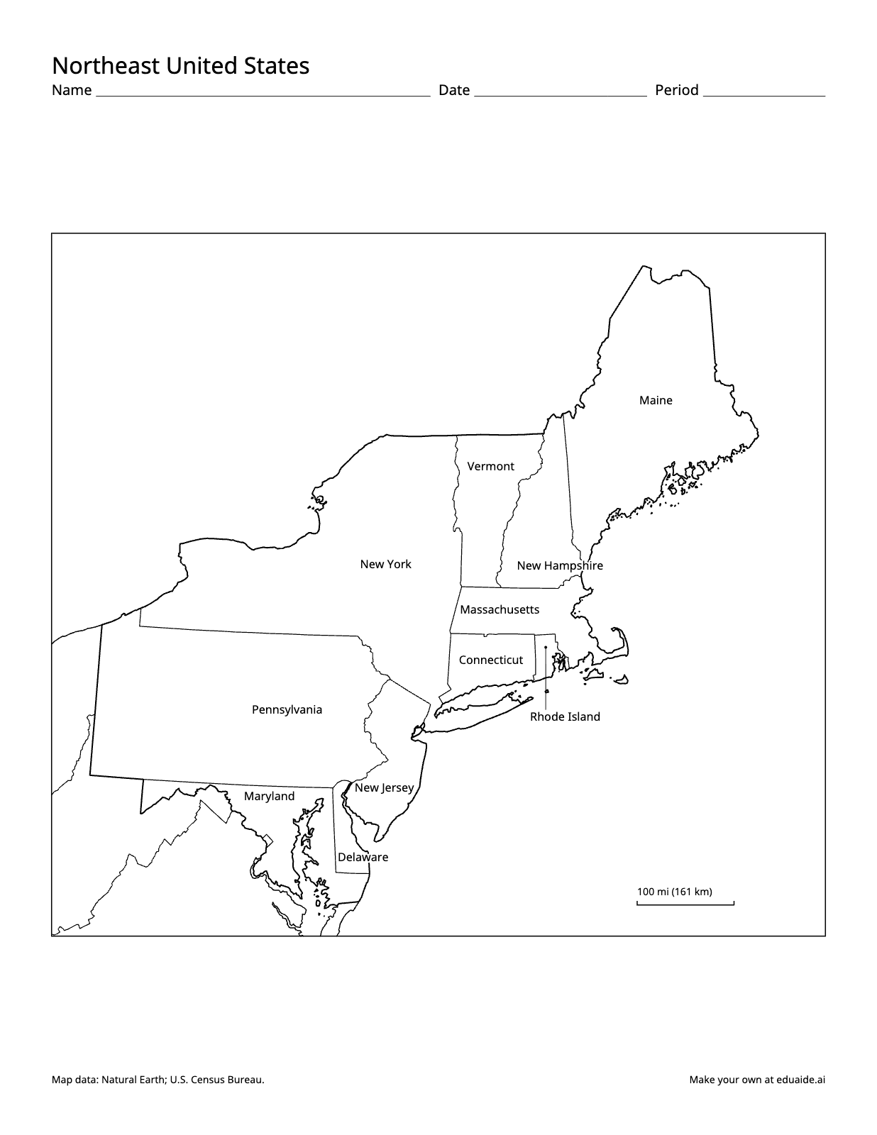
Map worksheet: Northeast United States. Labeled on the map: Maine, northeast; Vermont, north; New York, center; New Hampshire, center; Massachusetts, center; Connecticut, center; Rhode Island, center; Pennsylvania, southwest; Maryland, southwest; New Jersey, south; Delaware, south.
No account needed for the maps. The US regions quizzes is free with an Eduaide account. A numbered quiz for each of the five regions with answer lines and a word bank, Version B, and an answer key for each version.
Every map in the set
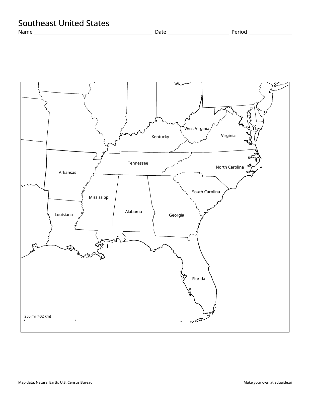
Map worksheet: Southeast United States. Labeled on the map: West Virginia, north; Kentucky, north; Virginia, northeast; Tennessee, north; North Carolina, east; Arkansas, west; Mississippi, west; South Carolina, east; Louisiana, west; Alabama, center; Georgia, center; Florida, south.
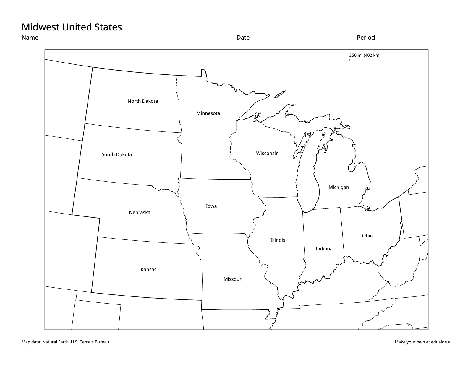
Map worksheet: Midwest United States. Labeled on the map: North Dakota, northwest; Minnesota, north; South Dakota, west; Wisconsin, center; Michigan, east; Iowa, center; Nebraska, west; Illinois, south; Indiana, southeast; Ohio, east; Kansas, southwest; Missouri, south.
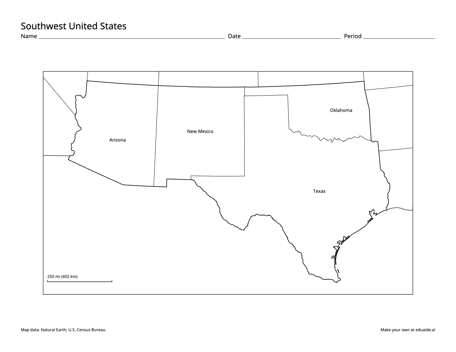
Map worksheet: Southwest United States. Labeled on the map: Oklahoma, northeast; Arizona, northwest; New Mexico, north; Texas, east.
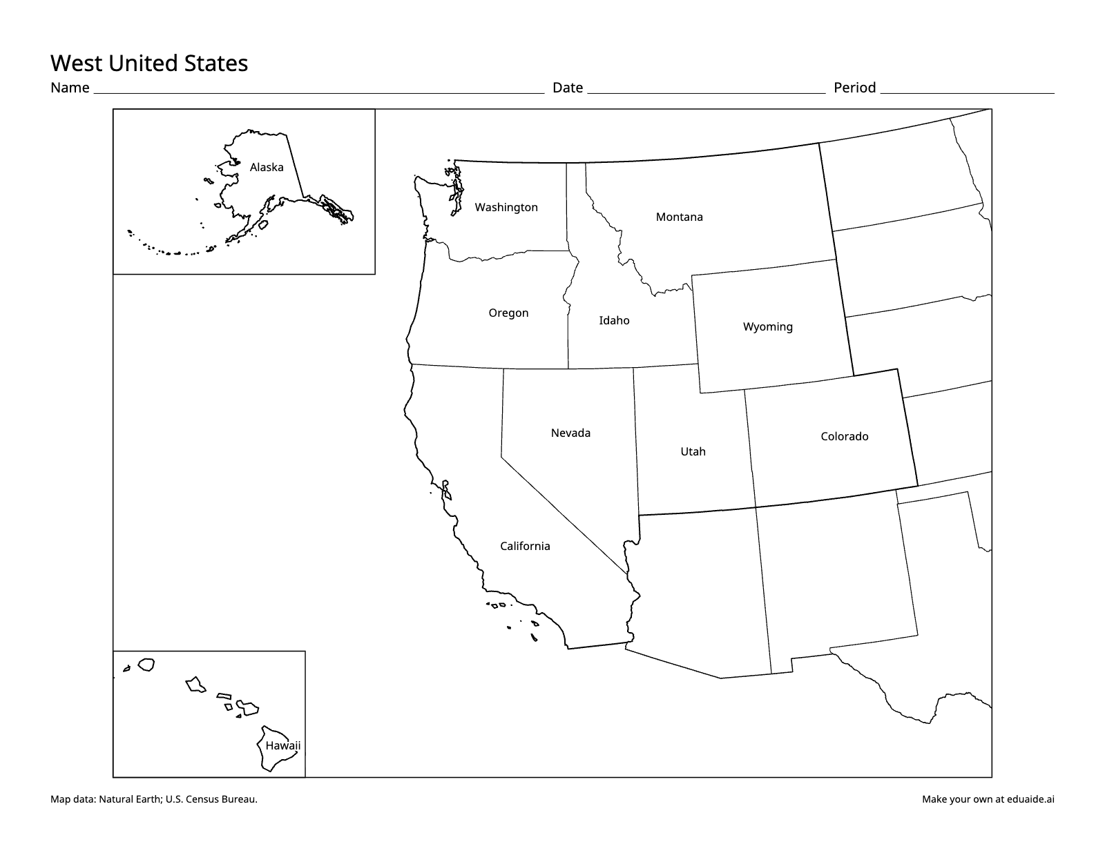
Map worksheet: West United States. Labeled on the map: Alaska, in the inset box at upper left; Washington, north; Montana, north; Oregon, north; Idaho, north; Wyoming, northeast; Nevada, center; Utah, center; Colorado, east; California, center; Hawaii, in the inset box at lower left.
How teachers use it
Which regions these are
These maps divide the United States into five regions: the Northeast, the Southeast, the Midwest, the Southwest and the West. They follow National Geographic's five regions, except that Delaware and Maryland are drawn with the Northeast. The Census Bureau uses four regions, and states near a boundary, such as Delaware, Maryland or Oklahoma, move between groupings. Tell students which grouping your class uses, and ask why a state might belong to two.
- Northeast: Maine, New Hampshire, Vermont, Massachusetts, Rhode Island, Connecticut, New York, New Jersey, Pennsylvania, Delaware and Maryland.
- Southeast: West Virginia, Virginia, Kentucky, Tennessee, North Carolina, South Carolina, Georgia, Florida, Alabama, Mississippi, Louisiana and Arkansas.
- Midwest: Ohio, Indiana, Illinois, Michigan, Wisconsin, Minnesota, Iowa, Missouri, Kansas, Nebraska, South Dakota and North Dakota.
- Southwest: Texas, Oklahoma, New Mexico and Arizona.
- West: Colorado, Wyoming, Montana, Idaho, Utah, Nevada, California, Oregon, Washington, Alaska and Hawaii.
Teach one region at a time
Each region is its own page, so you can hand out one map per week. Start with the blank map: students label the states they know, then use the labeled map to fill in the rest. Add the landforms, rivers or major cities of your reading as the week goes on.
Quiz each region
With a free account you can download a numbered quiz for every region, each with answer lines and a word bank, a Version B with the numbers shuffled, and answer keys. The five quizzes come in one PDF, in the same order as the maps.
Standards it supports
- C3 Framework, Geography: D2.Geo.2.3-5, using maps to explain relationships between the locations of places and regions and their environmental characteristics, and D2.Geo.3.3-5, using maps of different scales to describe where cultural and environmental characteristics are.
- State standards that ask students to identify and describe the regions of the United States, often in upper elementary social studies.
Printing tips
Print at 100% scale on US letter paper. The Midwest, Southwest and West print landscape, the others portrait. The West map shows Alaska and Hawaii in insets, which are not to scale or in place. Every page keeps a small credit line for the map data.
What teachers ask about these maps
Is it free?
Yes. The blank and labeled maps download free, with no account. A free Eduaide account also unlocks the US regions quizzes, and no credit card is needed.
Do I need an account?
Not for the blank and labeled maps: download them straight from this page. The numbered quiz, Version B and answer keys need a free account, made with Google, Microsoft or your email.
Can I copy these maps for my class?
Yes. You may print, copy and share them with the students you teach and their families, in a school, a homeschool or a co-op. Please keep the map data credit at the bottom of each page, and don't sell the maps.
Why is my state in a different region in our textbook?
No one set of regions is used everywhere. These maps use five regions; the Census Bureau uses four, and textbooks differ on states near a boundary, such as Delaware, Maryland and Oklahoma.
Is there one map with all five regions?
Not yet. Each region is its own page so its states are large enough to label. The blank US map shows all 50 states on one page.
Where Good Ideas Become Great Lessons
Start with an objective, a topic, or a source. Leave with classroom-ready materials you can teach from.